Hayley here: You’re trying the next version of My Future Radar. It’s still a beta, and I’d love to hear what you think.
Prefer the current site? Back to My Future Radar.
Severe weather outlook overview
- Sat, Oct 24
- Severe wind/hail and a tornado are possible across portions of New Mexico and far west Texas today.
- Sun, Oct 25
- Isolated large hail and an isolated tornado will be possible Sunday afternoon/evening across southern/eastern New Mexico and far west Texas.
- Mon, Oct 26
- Severe thunderstorm potential is expected to be low on Monday.
Hurricane forecast — radar, wind and pressure
RRFS — Western North Atlantic hurricane view (3 km; every 3–6 hours) · Pre-operational forecast
Initialized · Source: NOAA RRFS
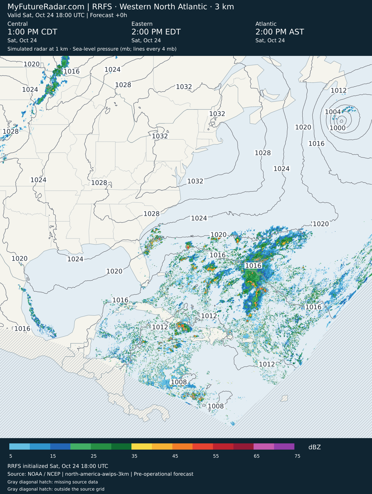
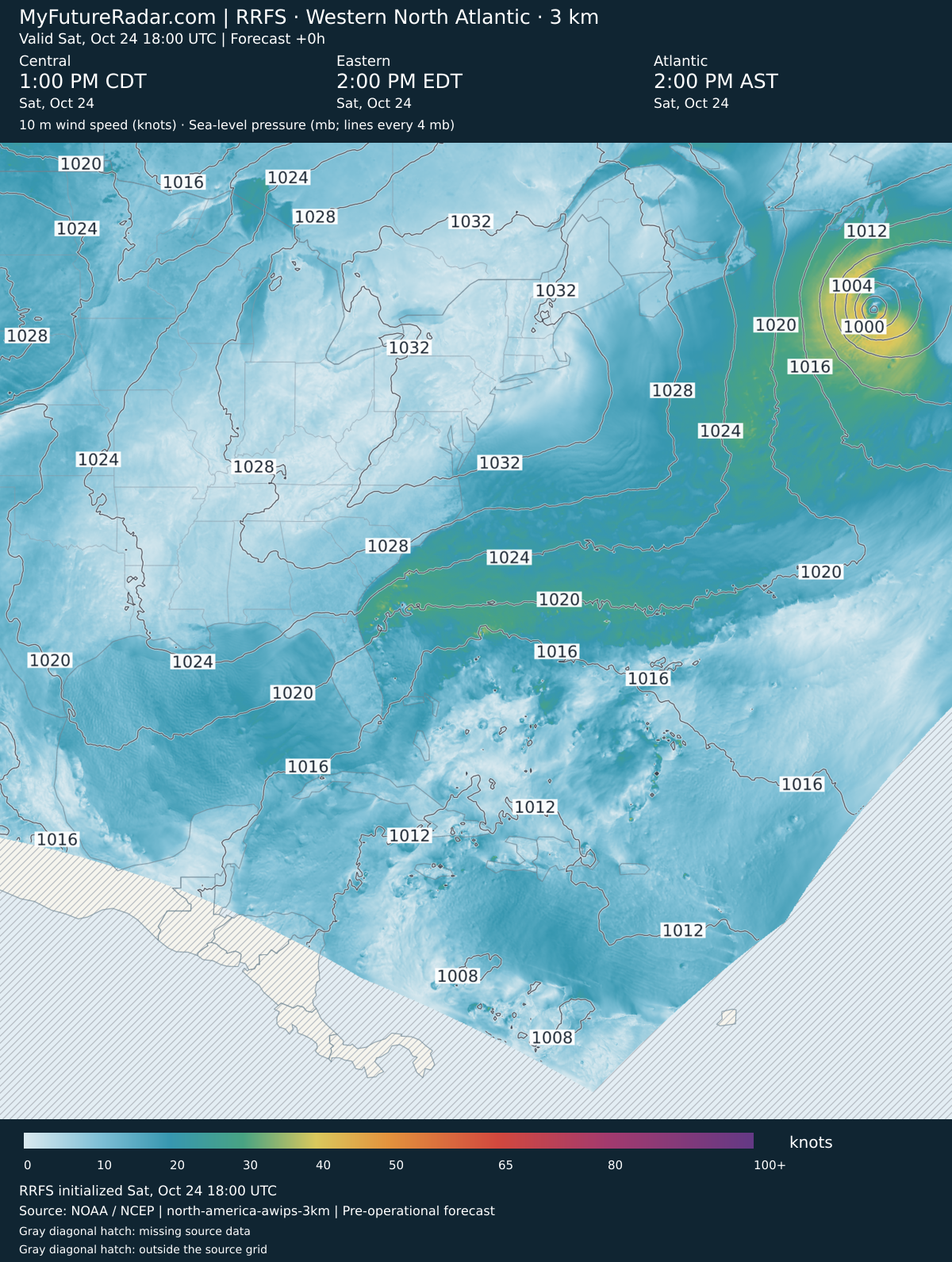
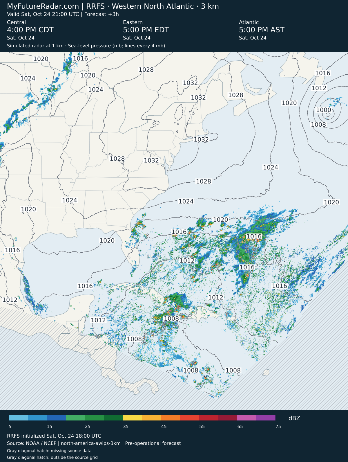
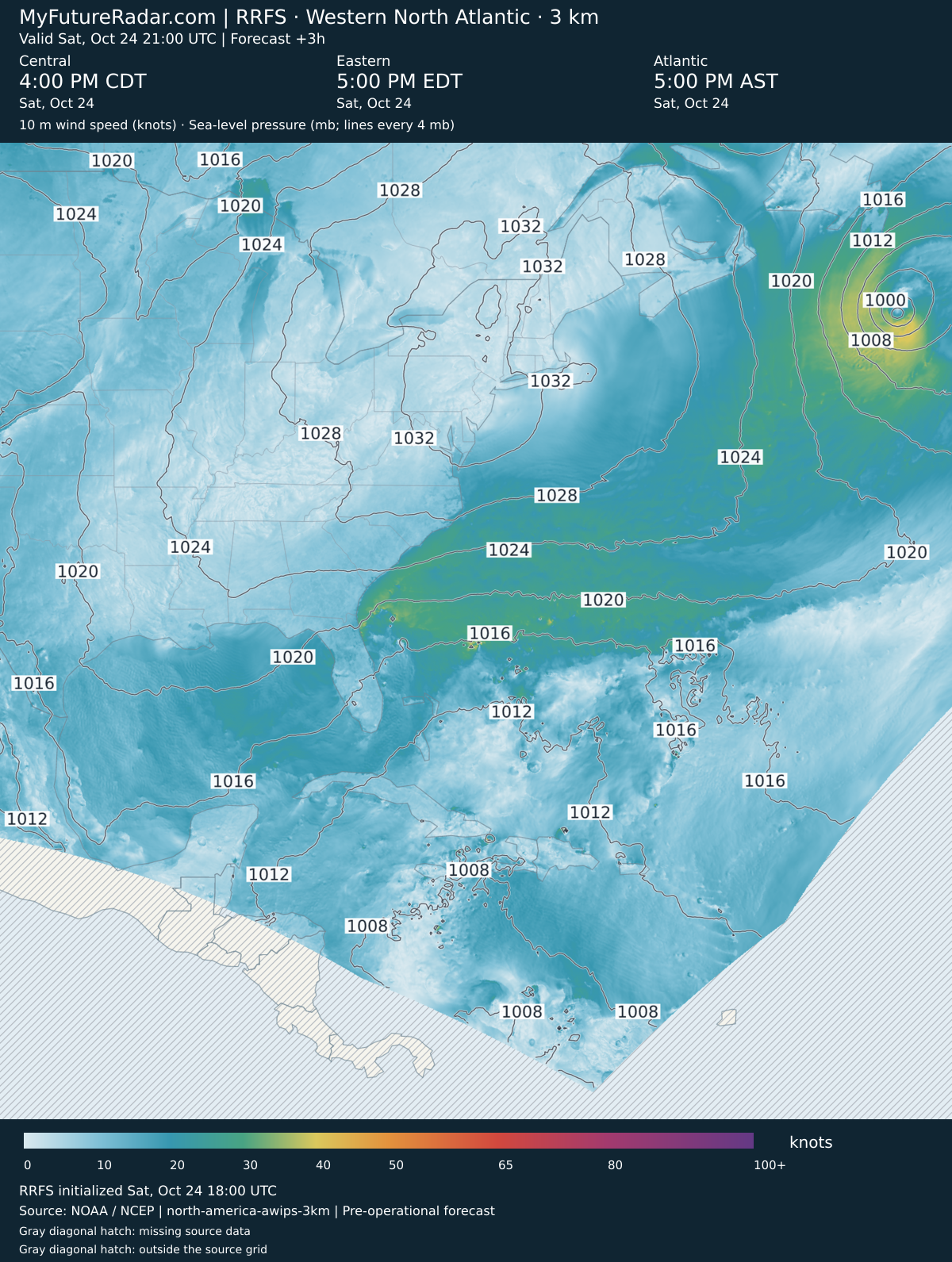
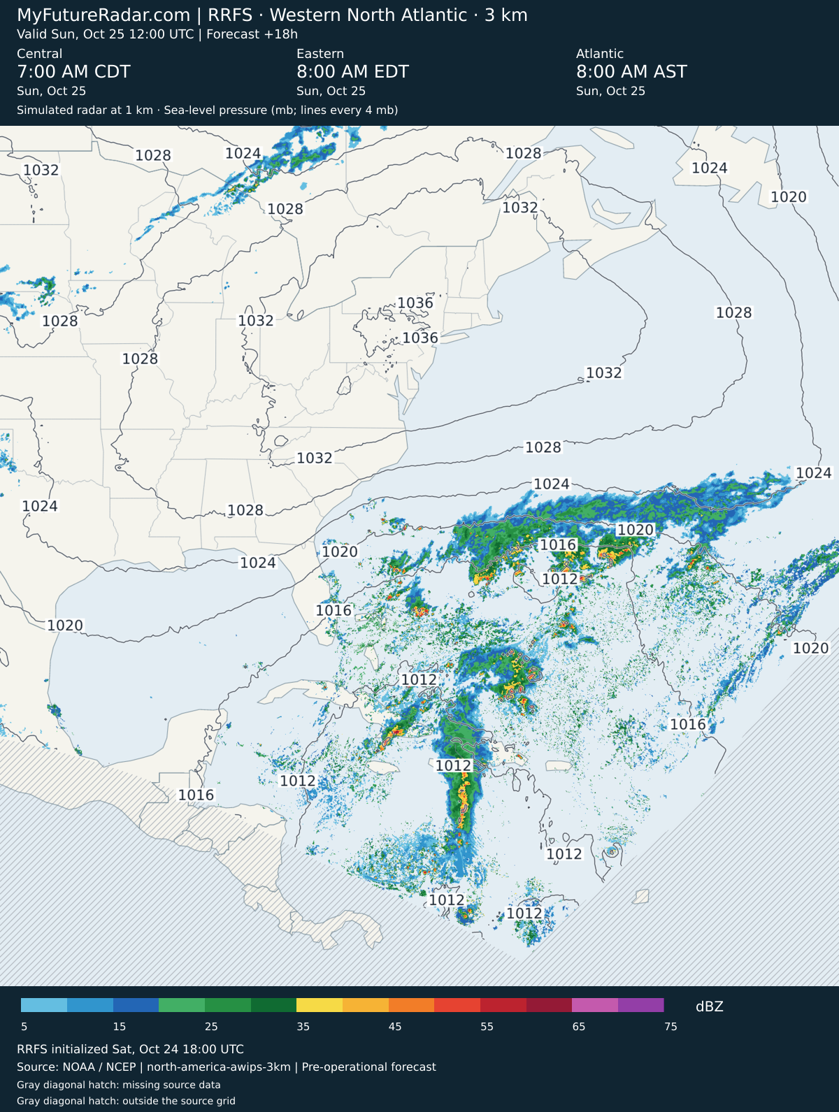
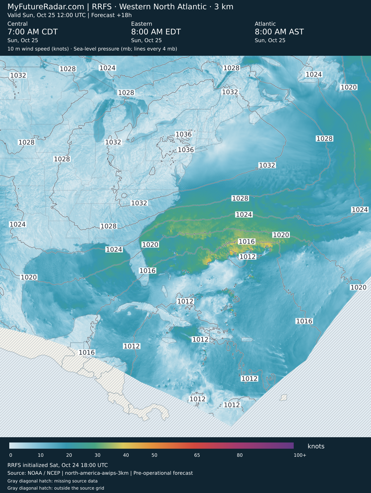
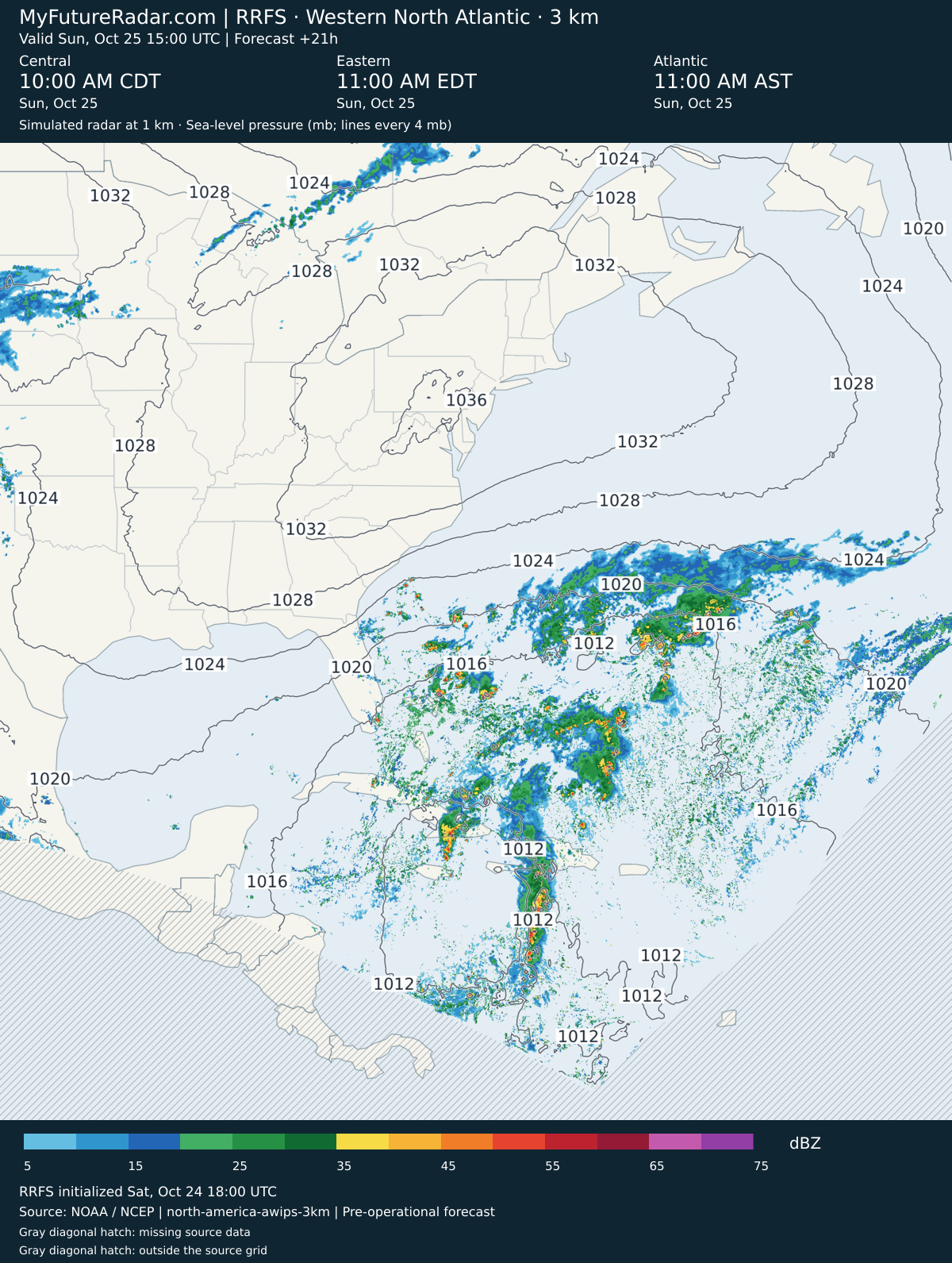
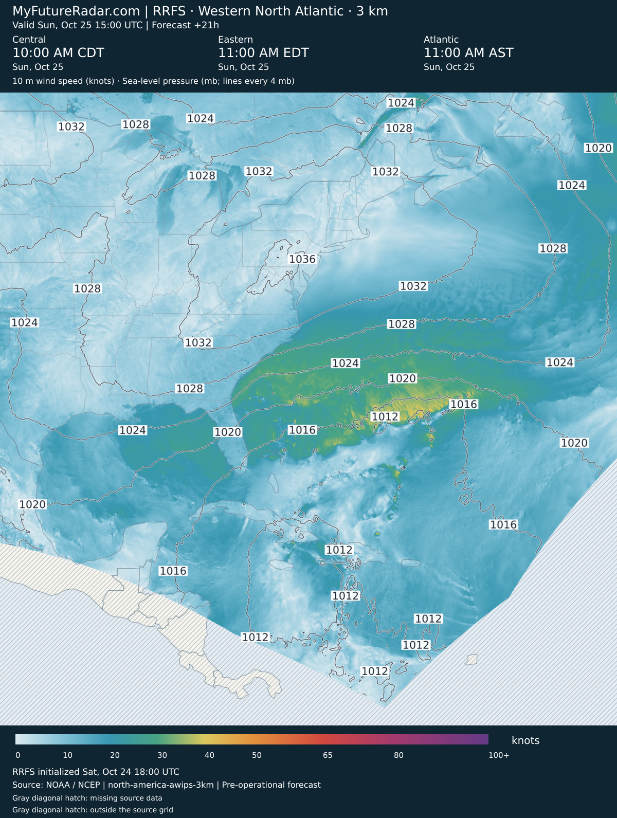
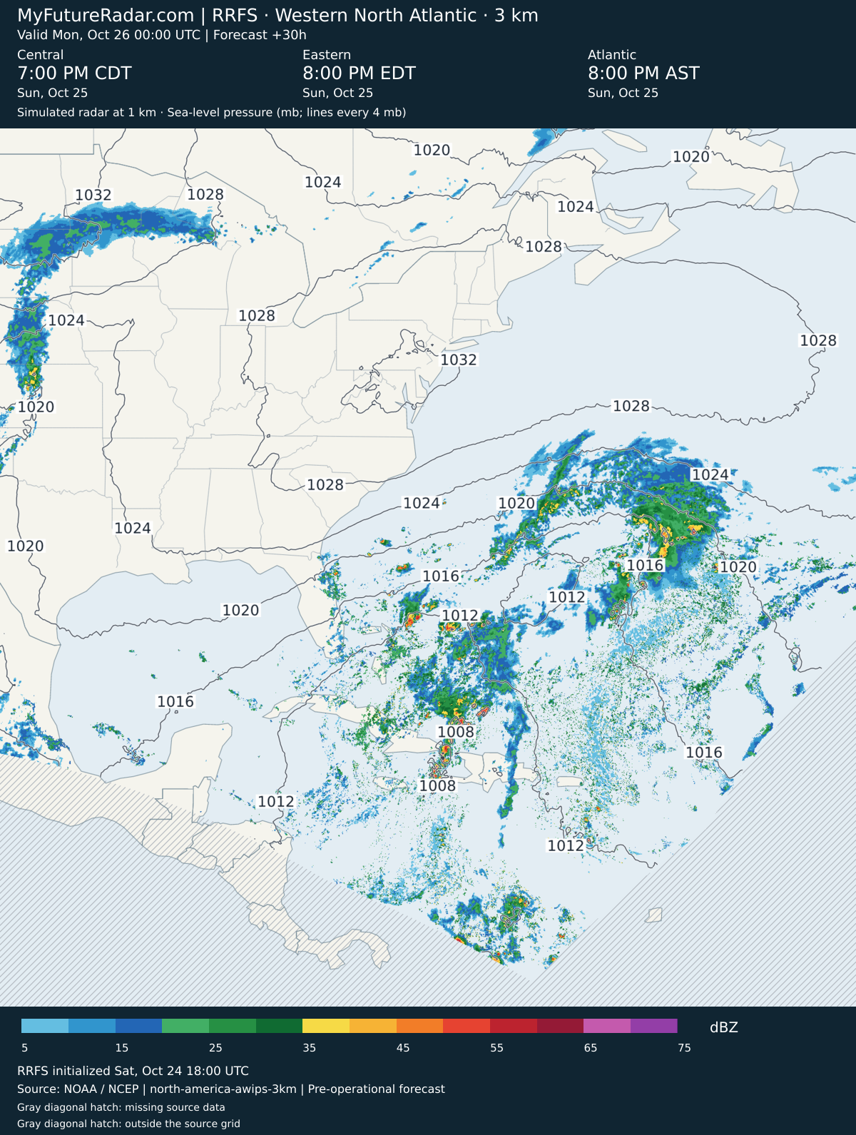
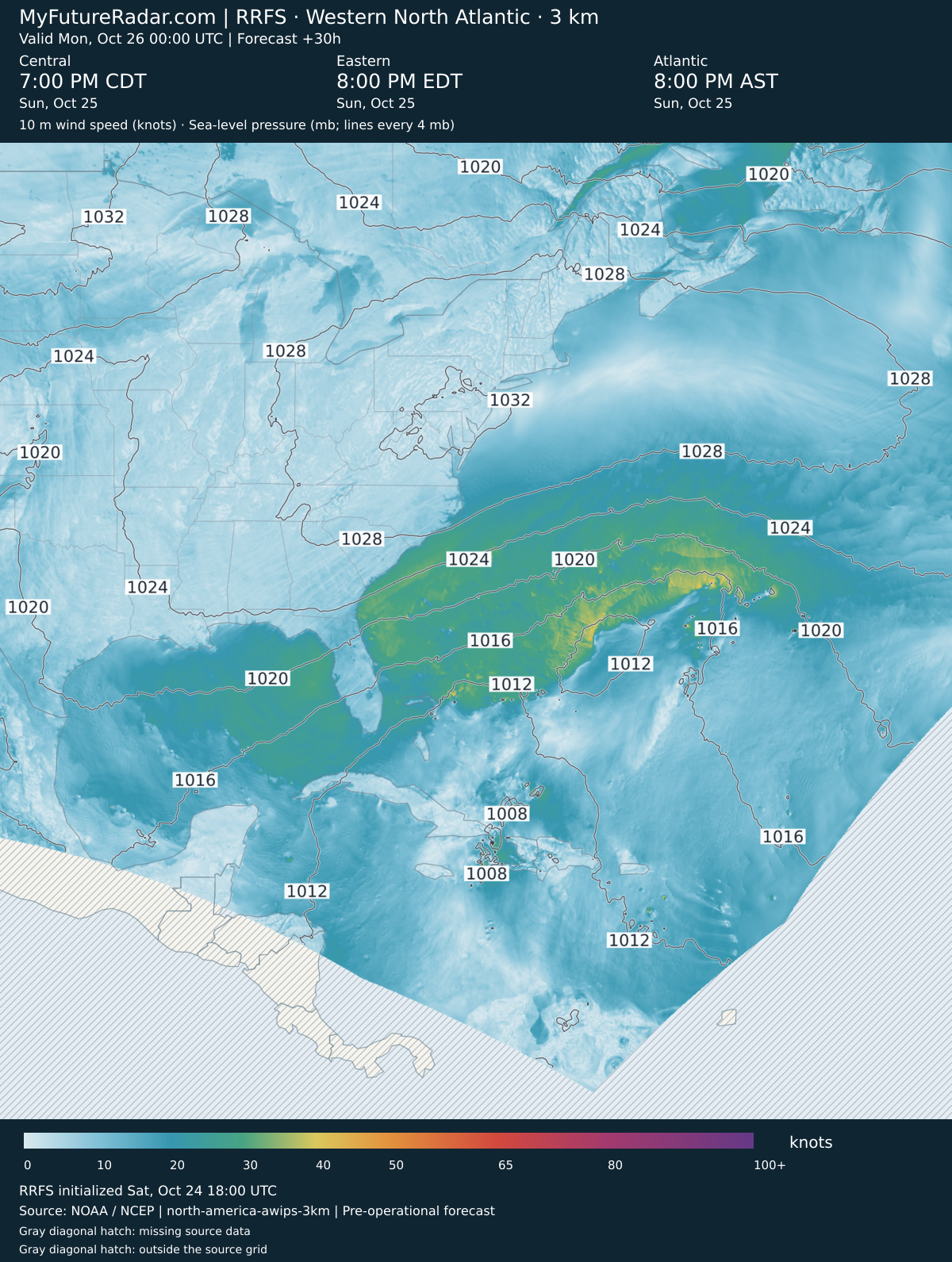
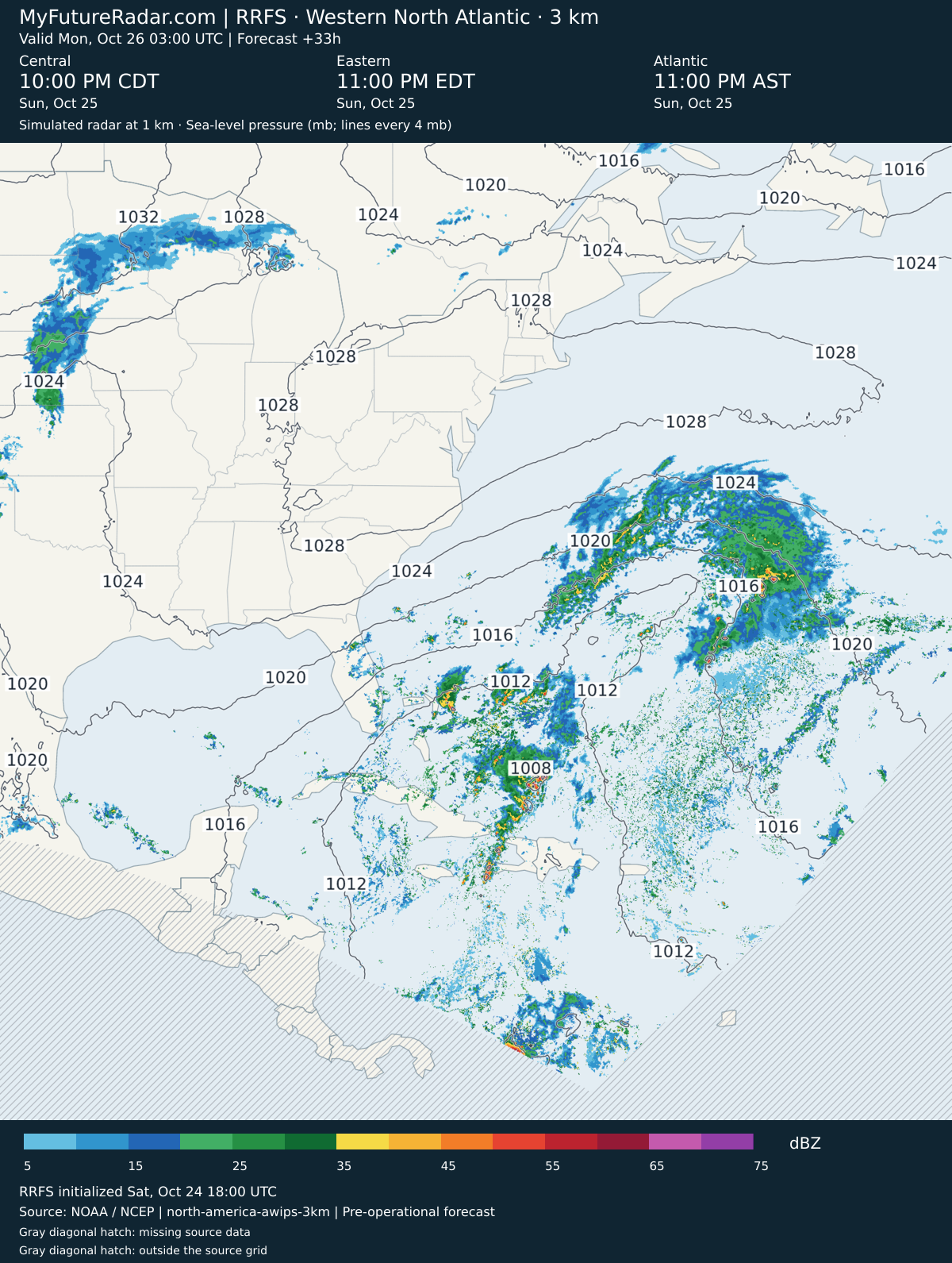
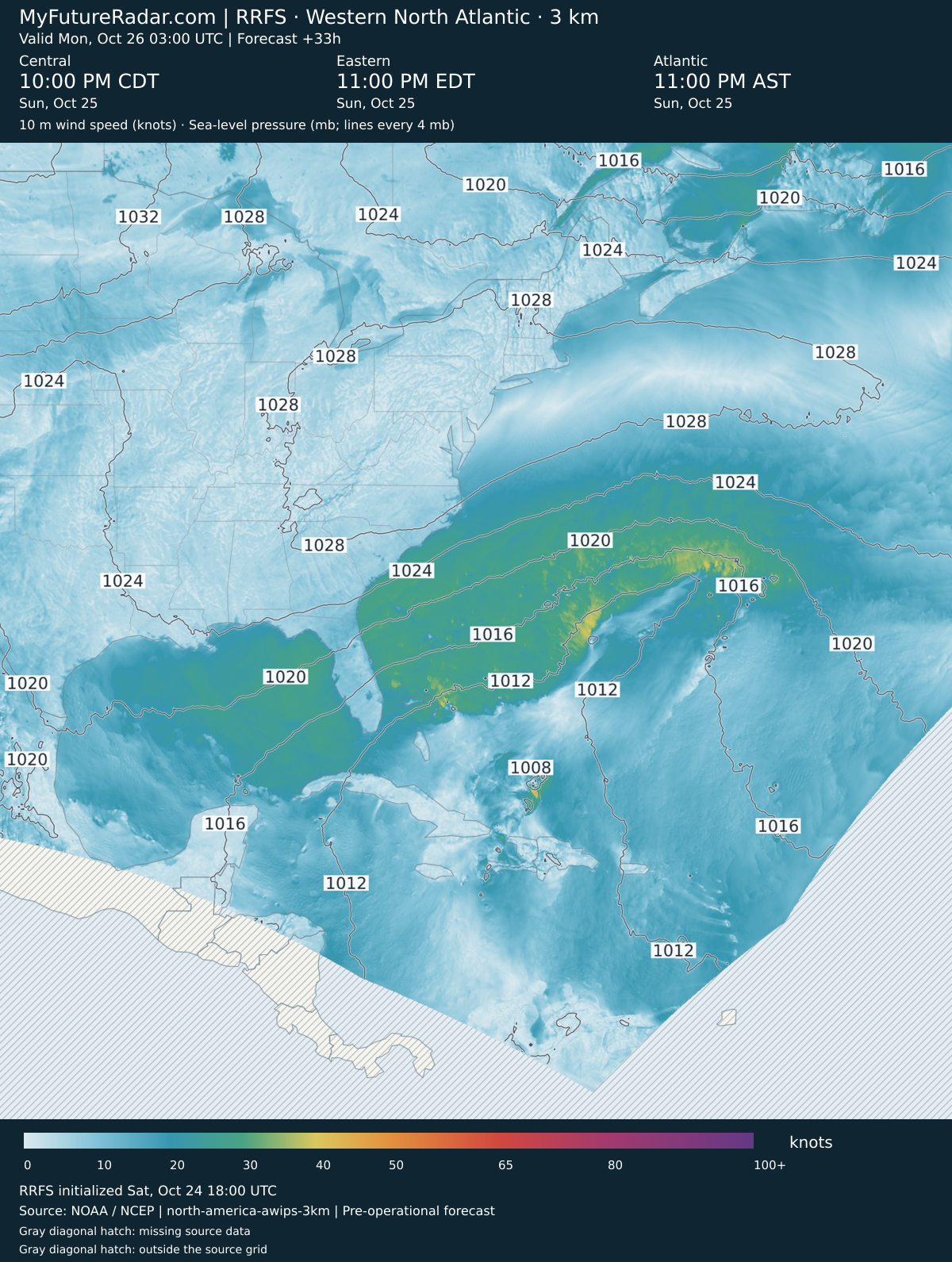
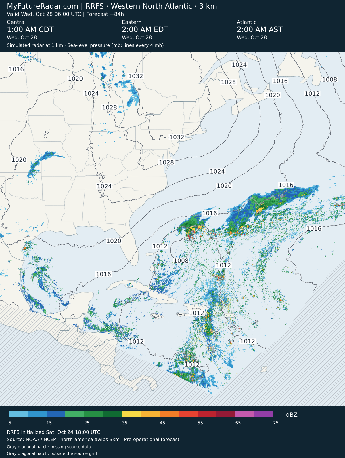
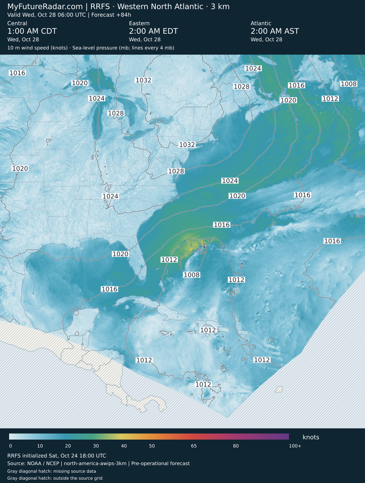
Forecast valid through · Simulated radar (dBZ) and 10 m wind speed (knots), both with mean sea-level pressure contours (mb / hPa).
This forecast period has ended; these images are not a current forecast.
The 3 km view is selected for the planned production update. Compare both resolutions and open the hourly 13 km sequence.
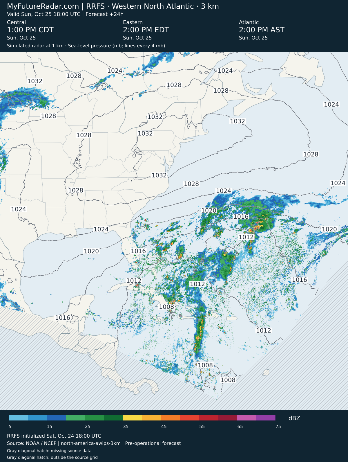
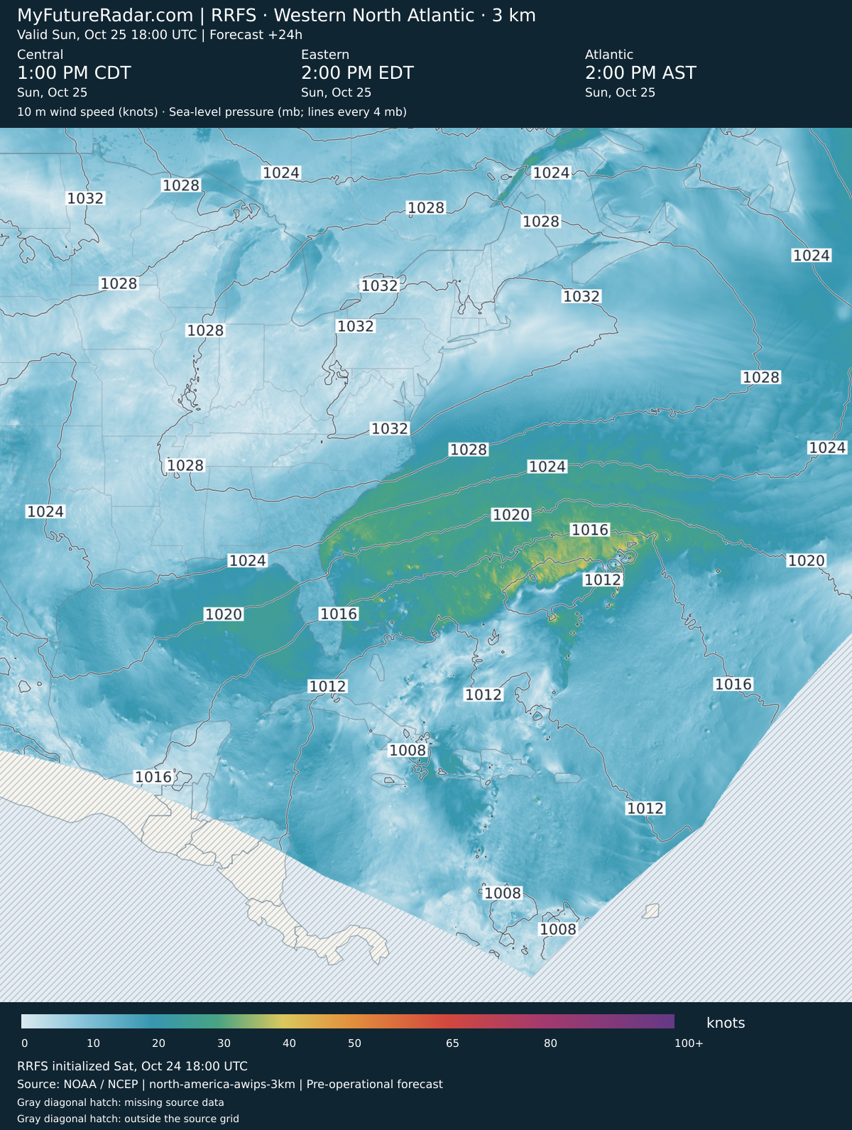
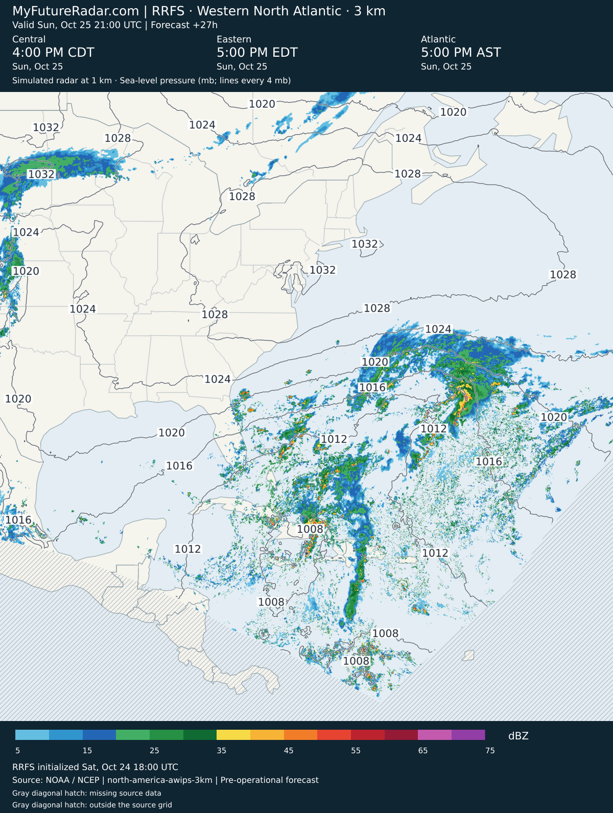
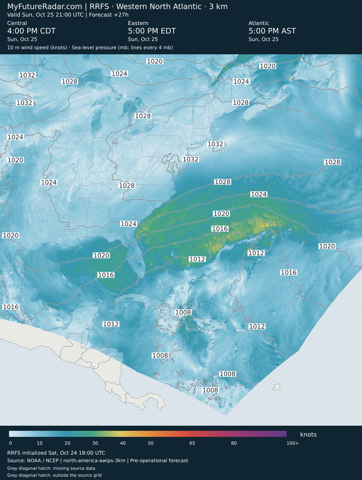
Radar and 10 m wind speed stay synchronized at the same forecast time, with mean sea-level pressure contours on both maps. Wind speed is shown in knots and pressure in mb (hPa).
Loading forecast…
Simulated radar + sea-level pressure
10 m wind speed + sea-level pressure
Keyboard: Space to play/pause; ←/→ to step.
Loading forecast…
Individual Forecast Images
Model initialized · 25 native forecast times.
RRFS — Western North Atlantic hurricane view (3 km; every 3–6 hours) — (+0 hours)
Jump back to animated forecast
Simulated radar + sea-level pressure
10 m wind speed + sea-level pressure
RRFS — Western North Atlantic hurricane view (3 km; every 3–6 hours) — (+3 hours)
Jump back to animated forecast
Simulated radar + sea-level pressure
10 m wind speed + sea-level pressure
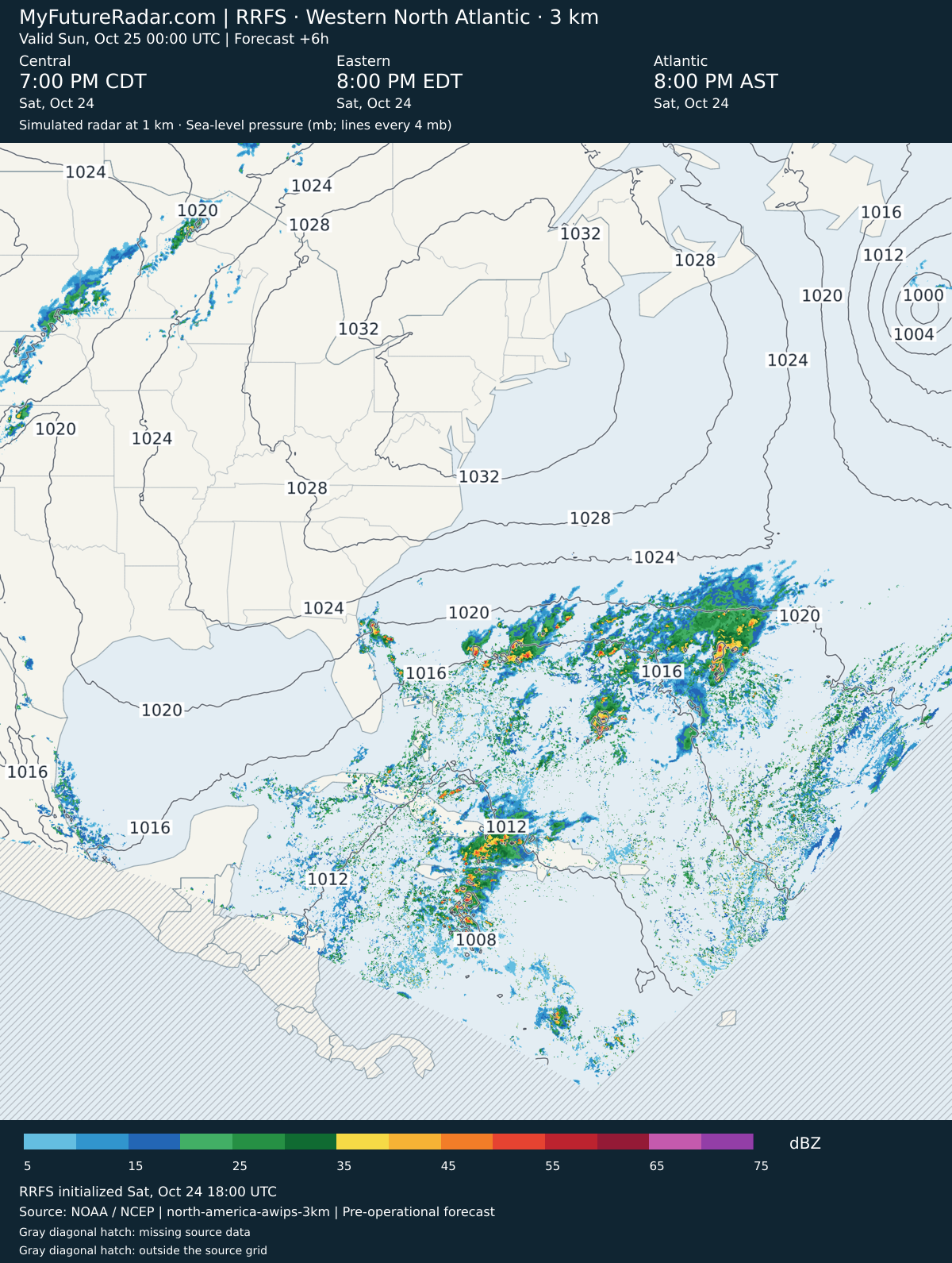
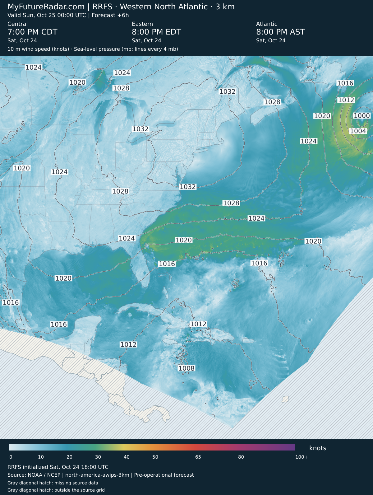
RRFS — Western North Atlantic hurricane view (3 km; every 3–6 hours) — (+6 hours)
Jump back to animated forecast
Simulated radar + sea-level pressure
10 m wind speed + sea-level pressure
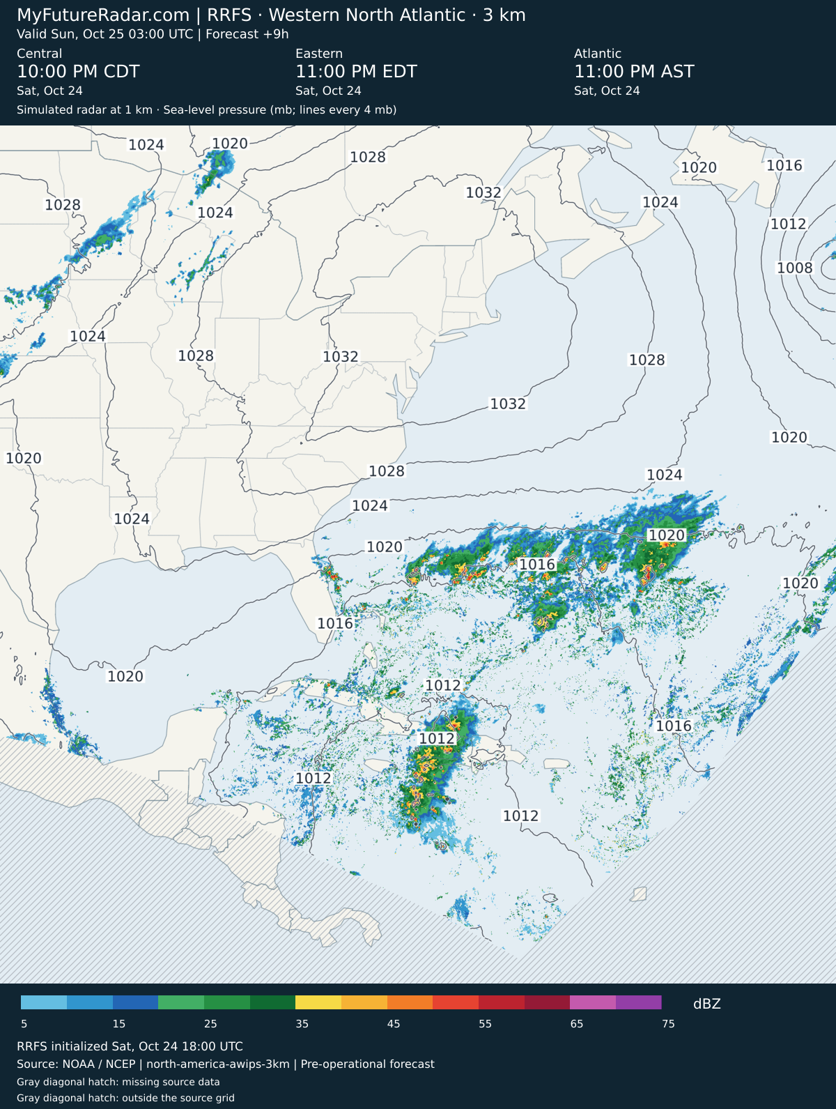
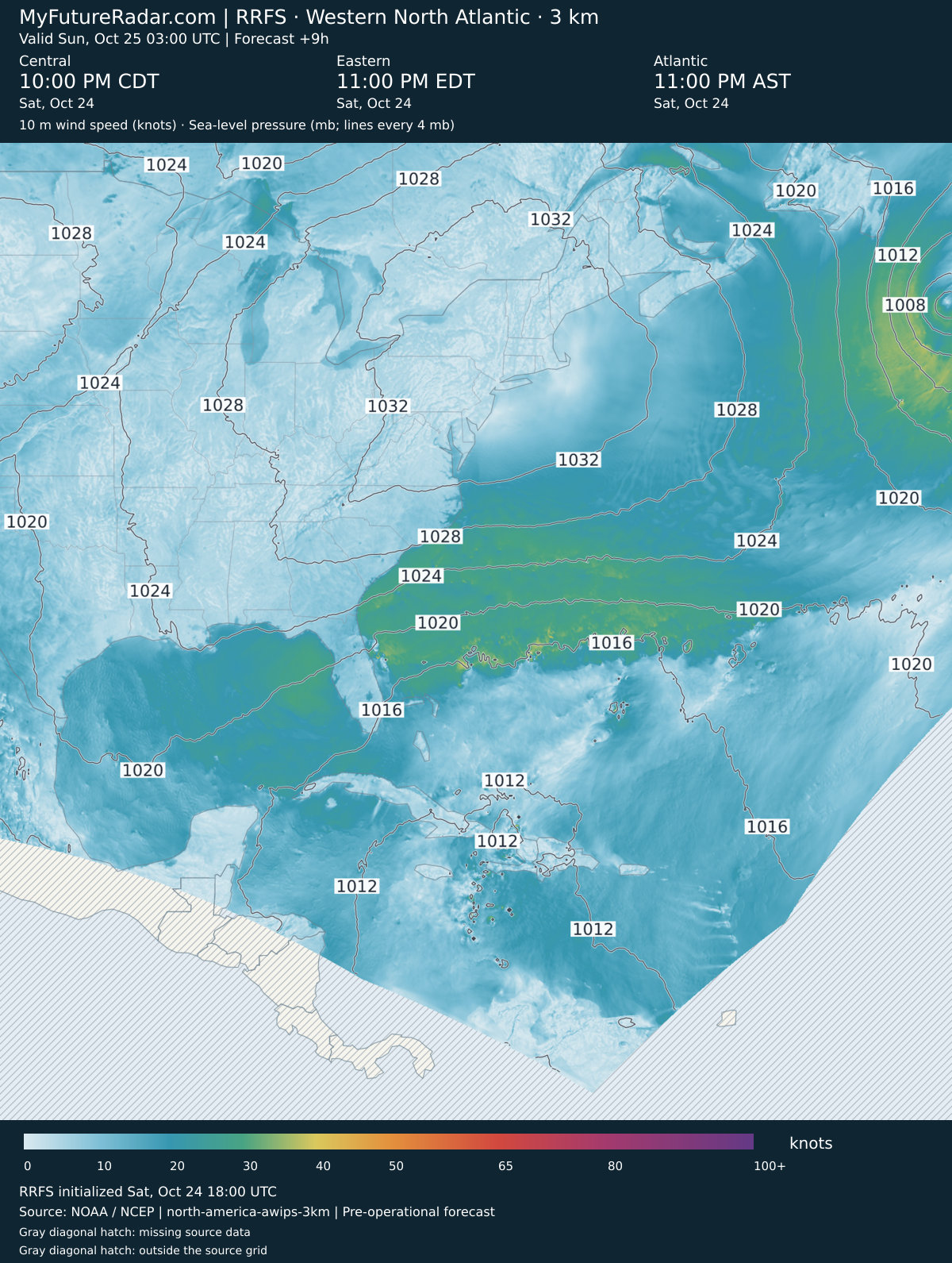
RRFS — Western North Atlantic hurricane view (3 km; every 3–6 hours) — (+9 hours)
Jump back to animated forecast
Simulated radar + sea-level pressure
10 m wind speed + sea-level pressure
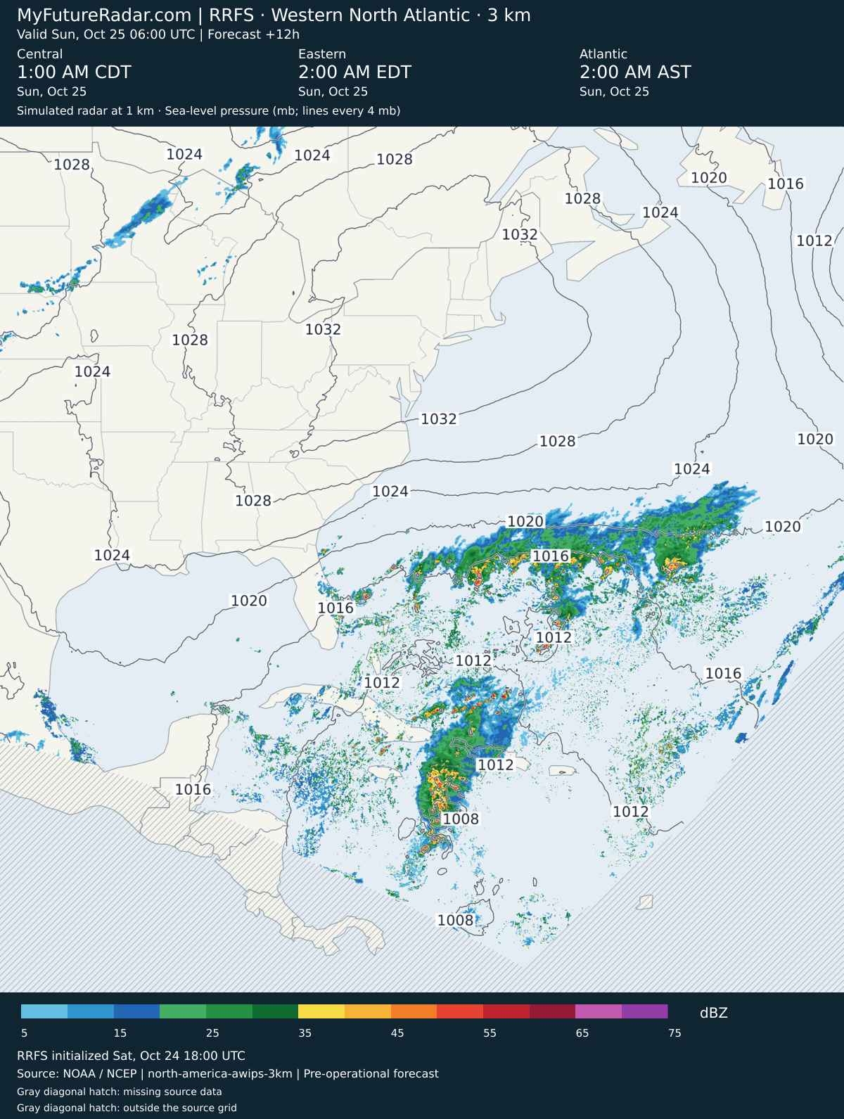
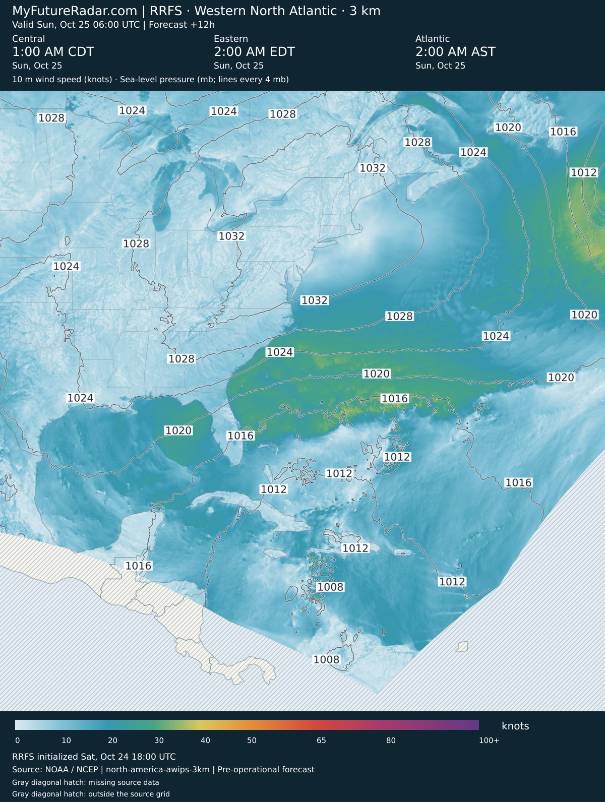
RRFS — Western North Atlantic hurricane view (3 km; every 3–6 hours) — (+12 hours)
Jump back to animated forecast
Simulated radar + sea-level pressure
10 m wind speed + sea-level pressure
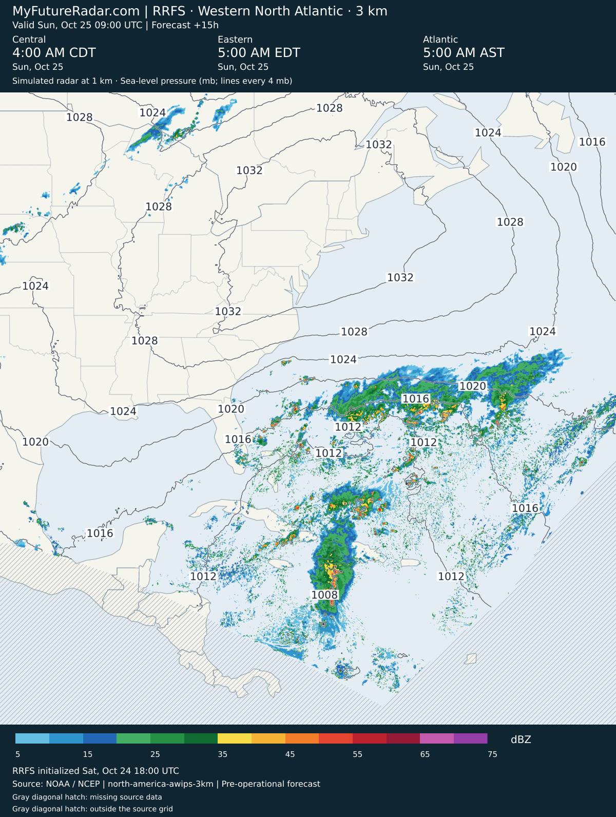
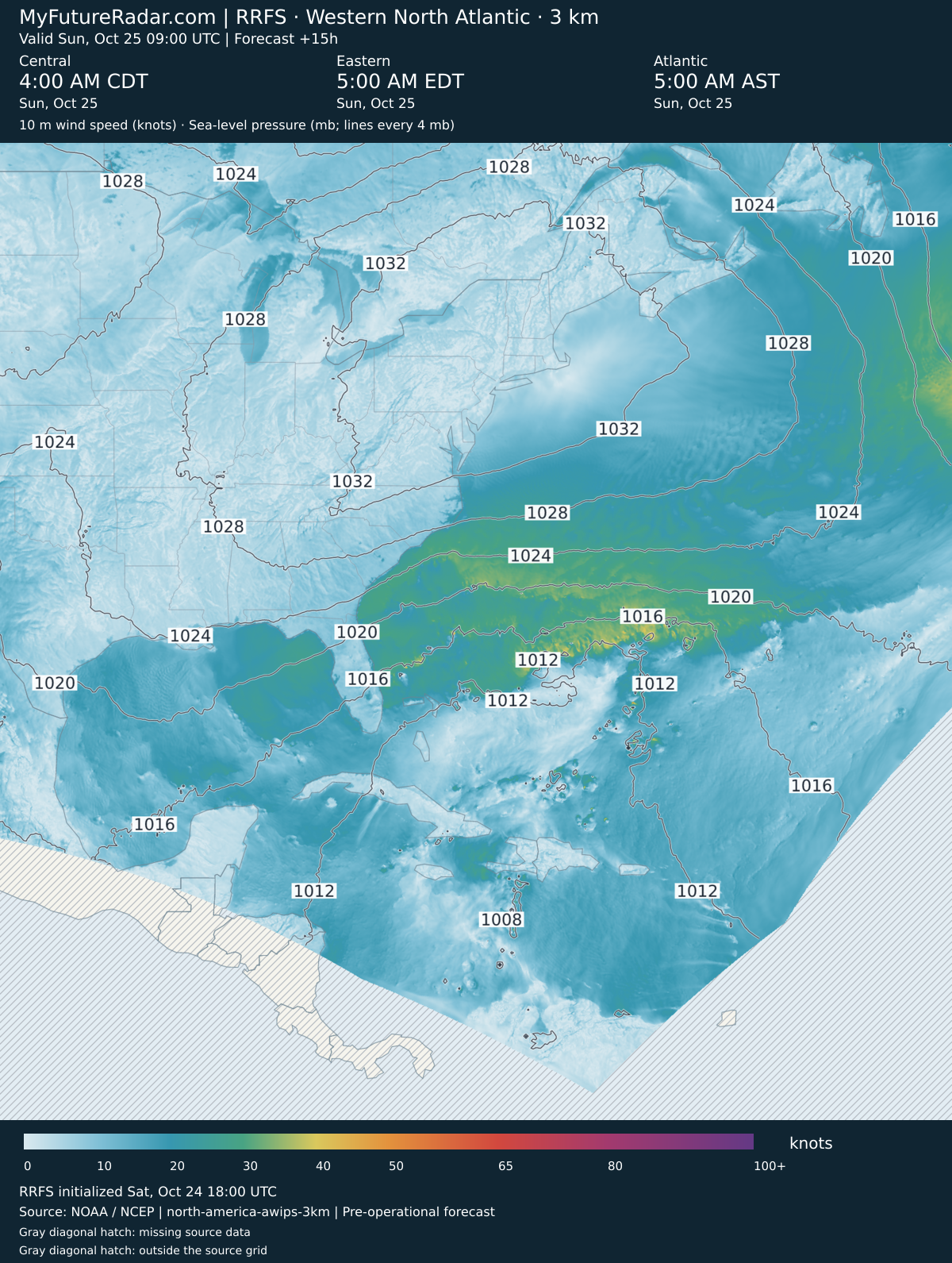
RRFS — Western North Atlantic hurricane view (3 km; every 3–6 hours) — (+15 hours)
Jump back to animated forecast
Simulated radar + sea-level pressure
10 m wind speed + sea-level pressure
RRFS — Western North Atlantic hurricane view (3 km; every 3–6 hours) — (+18 hours)
Jump back to animated forecast
Simulated radar + sea-level pressure
10 m wind speed + sea-level pressure
RRFS — Western North Atlantic hurricane view (3 km; every 3–6 hours) — (+21 hours)
Jump back to animated forecast
Simulated radar + sea-level pressure
10 m wind speed + sea-level pressure
RRFS — Western North Atlantic hurricane view (3 km; every 3–6 hours) — (+24 hours)
Jump back to animated forecast
Simulated radar + sea-level pressure
10 m wind speed + sea-level pressure
RRFS — Western North Atlantic hurricane view (3 km; every 3–6 hours) — (+27 hours)
Jump back to animated forecast
Simulated radar + sea-level pressure
10 m wind speed + sea-level pressure
RRFS — Western North Atlantic hurricane view (3 km; every 3–6 hours) — (+30 hours)
Jump back to animated forecast
Simulated radar + sea-level pressure
10 m wind speed + sea-level pressure
RRFS — Western North Atlantic hurricane view (3 km; every 3–6 hours) — (+33 hours)
Jump back to animated forecast
Simulated radar + sea-level pressure
10 m wind speed + sea-level pressure
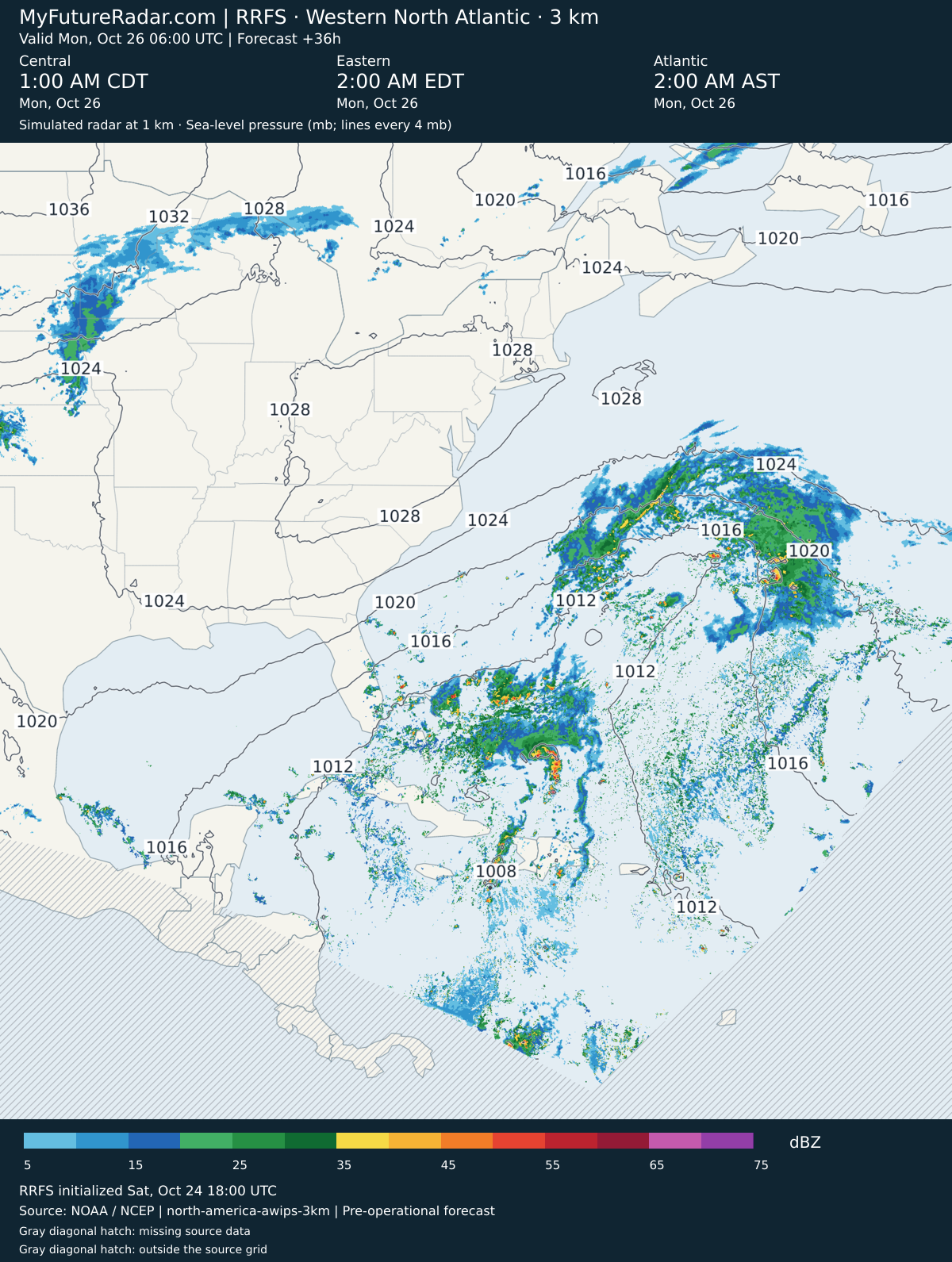
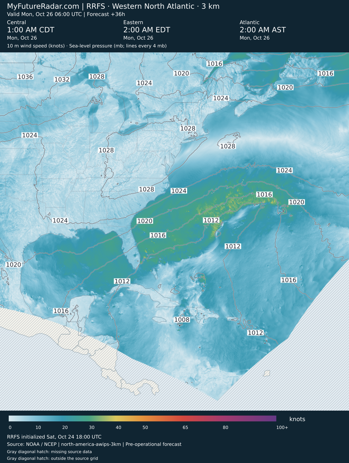
RRFS — Western North Atlantic hurricane view (3 km; every 3–6 hours) — (+36 hours)
Jump back to animated forecast
Simulated radar + sea-level pressure
10 m wind speed + sea-level pressure
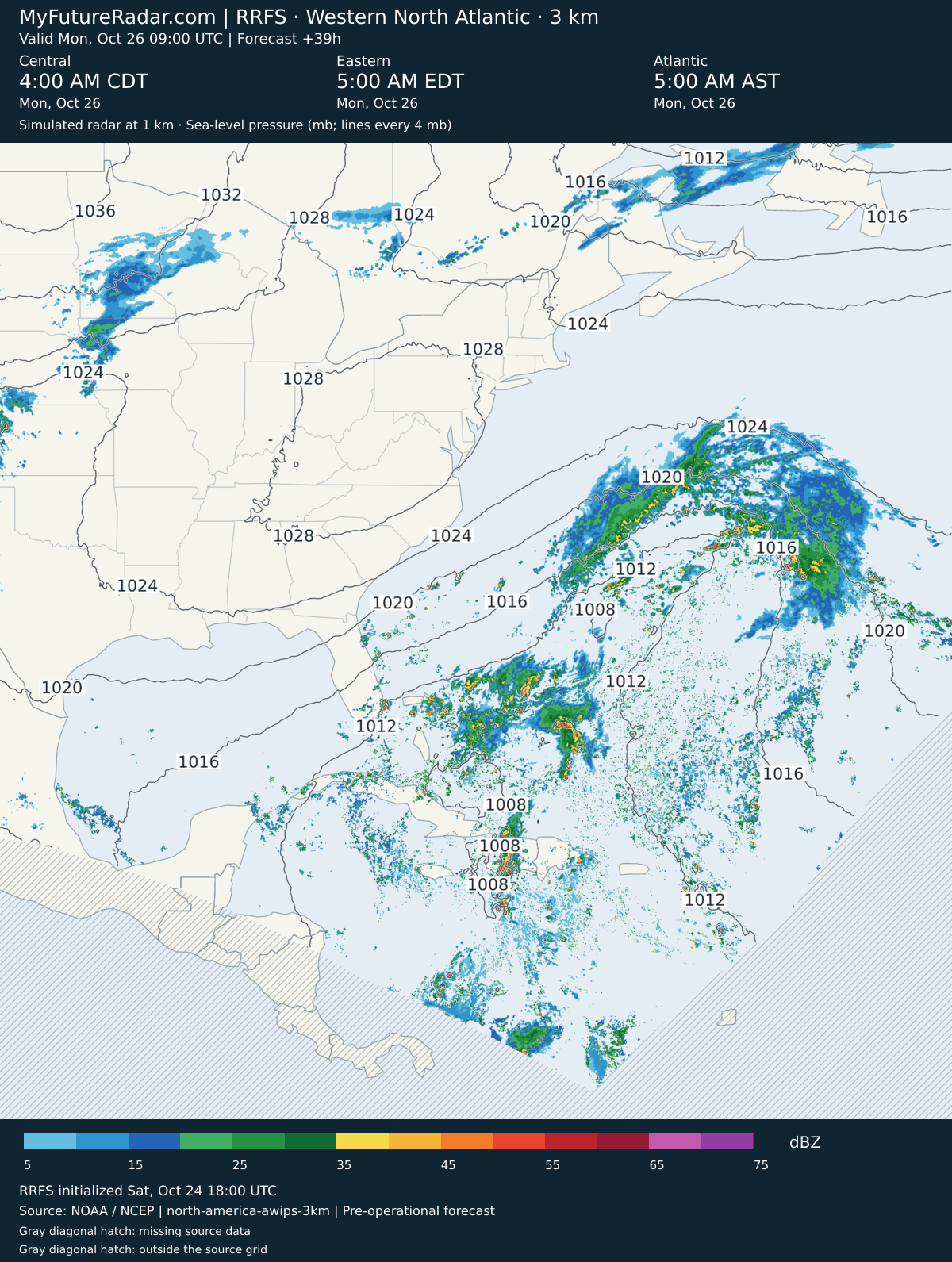
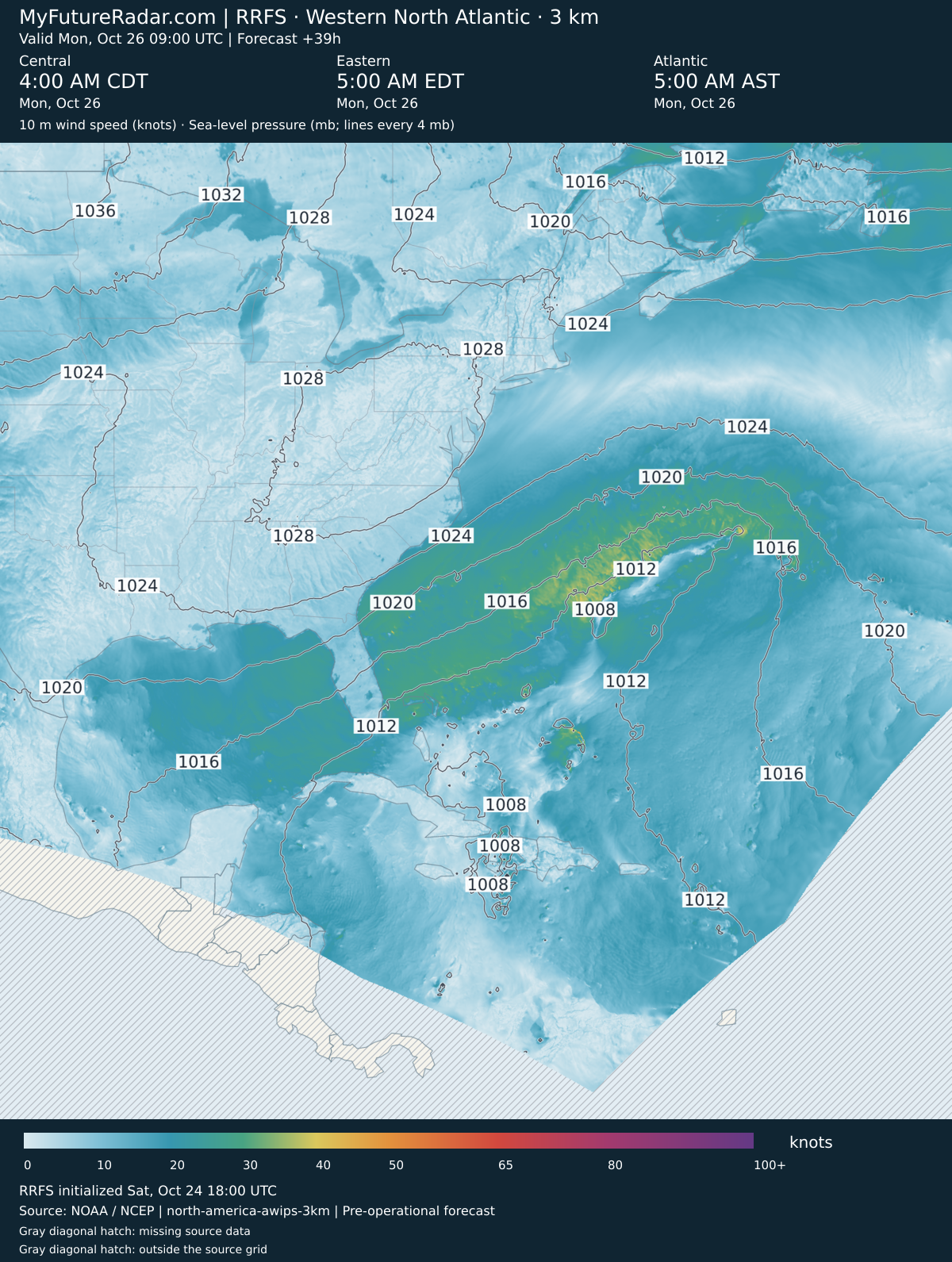
RRFS — Western North Atlantic hurricane view (3 km; every 3–6 hours) — (+39 hours)
Jump back to animated forecast
Simulated radar + sea-level pressure
10 m wind speed + sea-level pressure
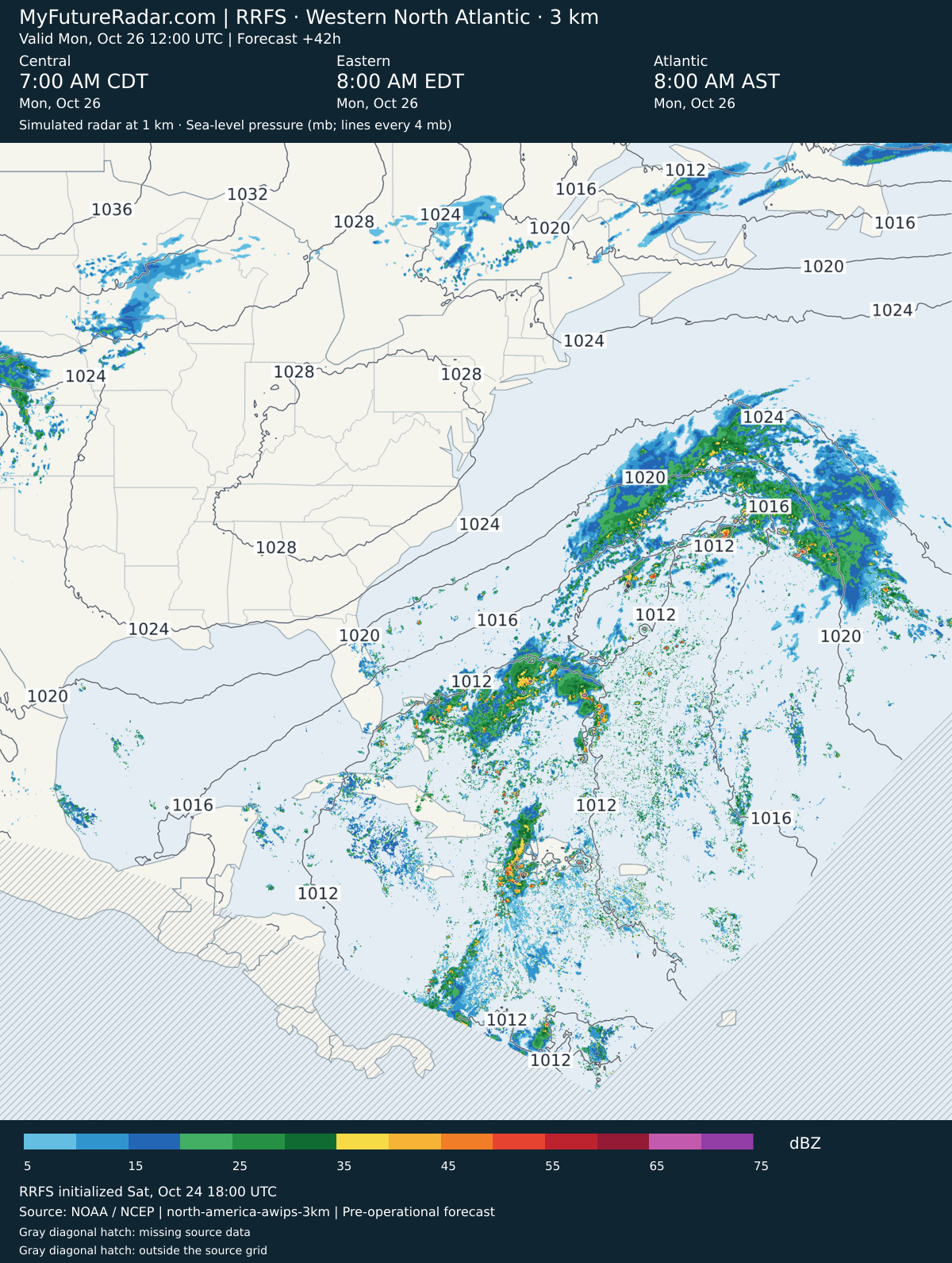
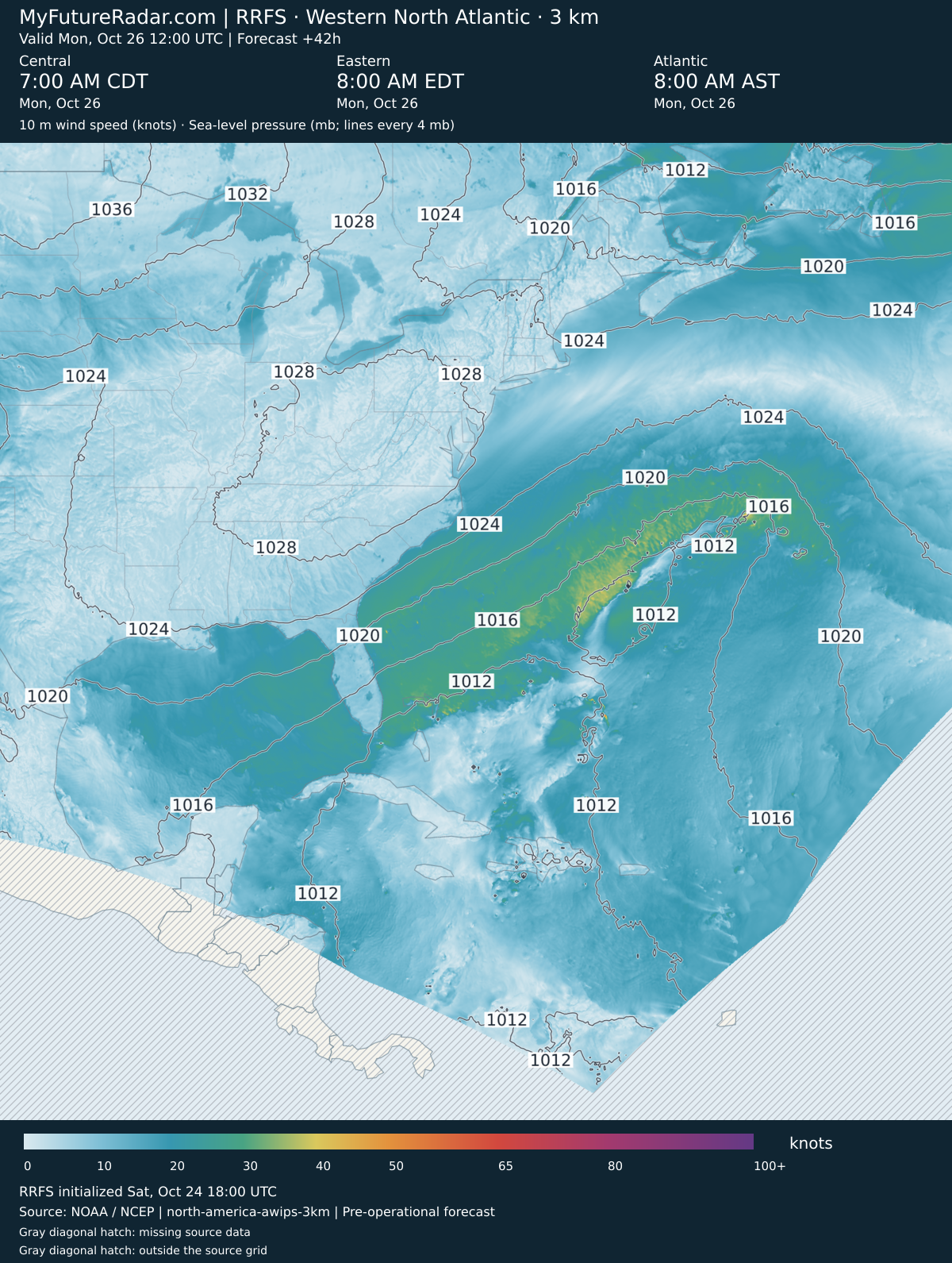
RRFS — Western North Atlantic hurricane view (3 km; every 3–6 hours) — (+42 hours)
Jump back to animated forecast
Simulated radar + sea-level pressure
10 m wind speed + sea-level pressure
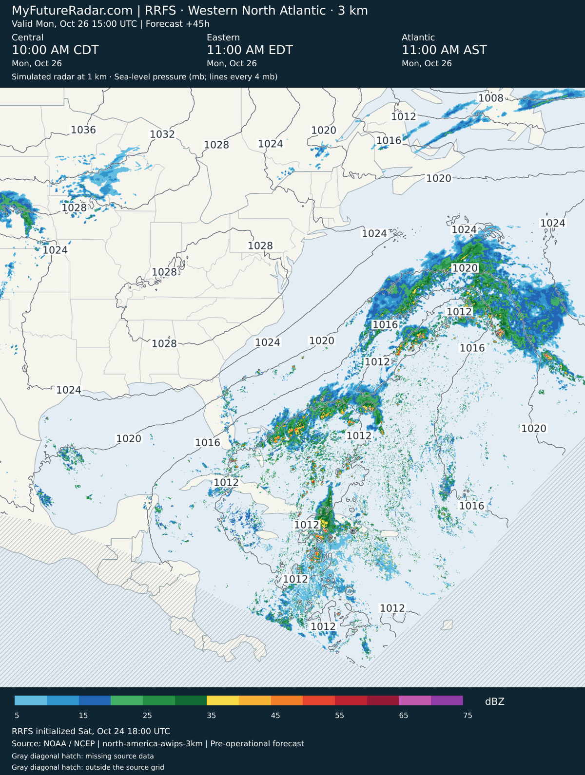
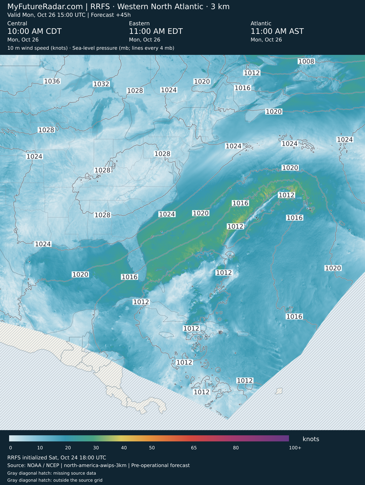
RRFS — Western North Atlantic hurricane view (3 km; every 3–6 hours) — (+45 hours)
Jump back to animated forecast
Simulated radar + sea-level pressure
10 m wind speed + sea-level pressure
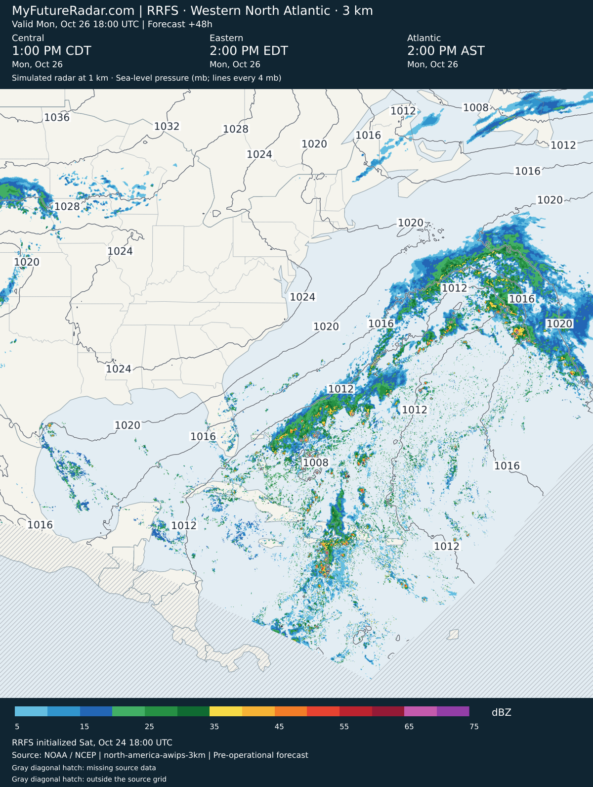
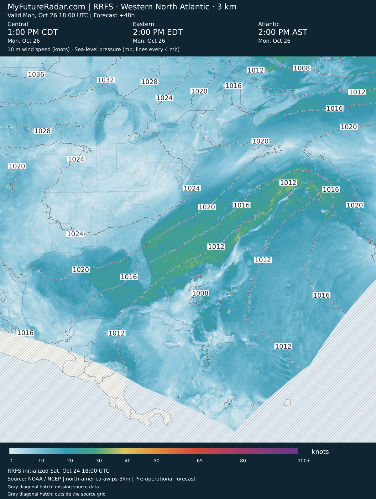
RRFS — Western North Atlantic hurricane view (3 km; every 3–6 hours) — (+48 hours)
Jump back to animated forecast
Simulated radar + sea-level pressure
10 m wind speed + sea-level pressure
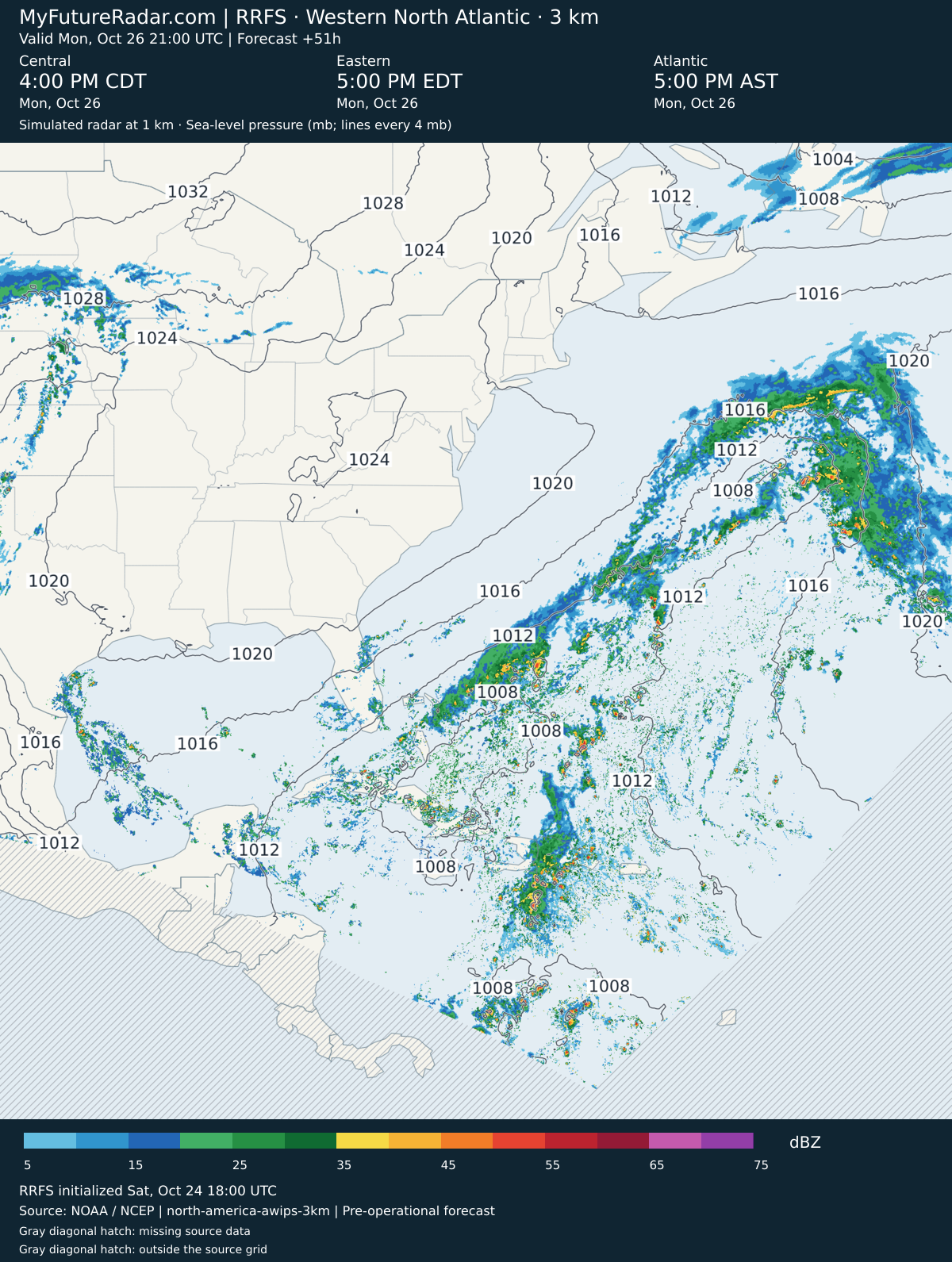
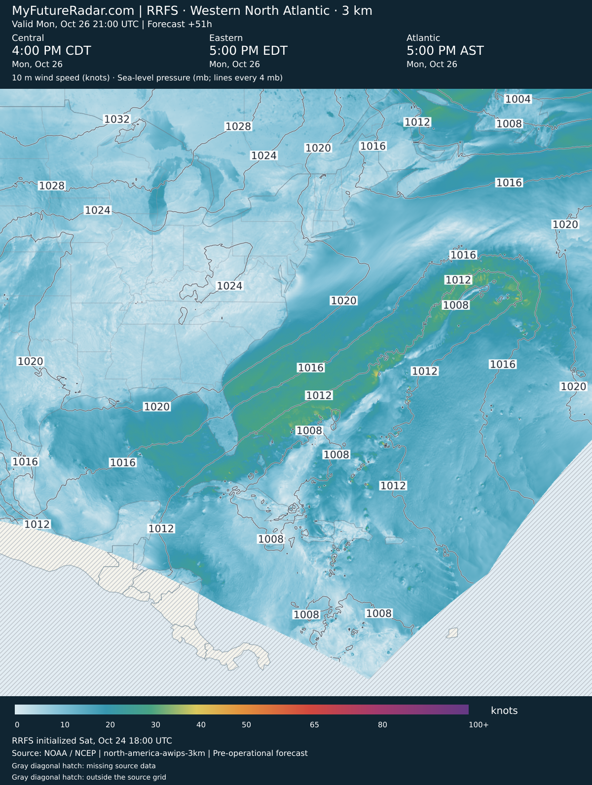
RRFS — Western North Atlantic hurricane view (3 km; every 3–6 hours) — (+51 hours)
Jump back to animated forecast
Simulated radar + sea-level pressure
10 m wind speed + sea-level pressure
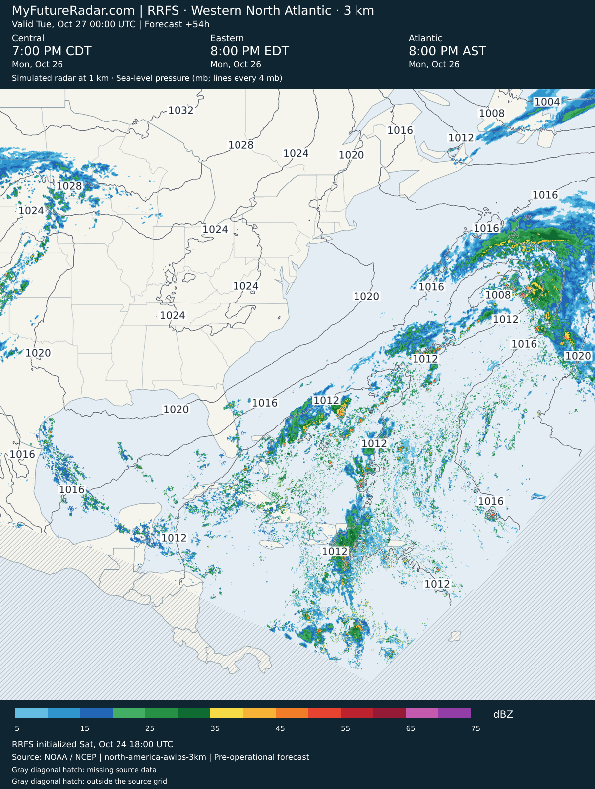
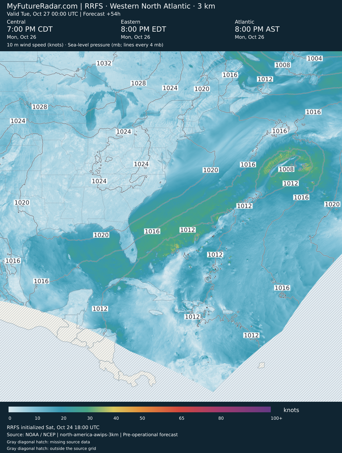
RRFS — Western North Atlantic hurricane view (3 km; every 3–6 hours) — (+54 hours)
Jump back to animated forecast
Simulated radar + sea-level pressure
10 m wind speed + sea-level pressure
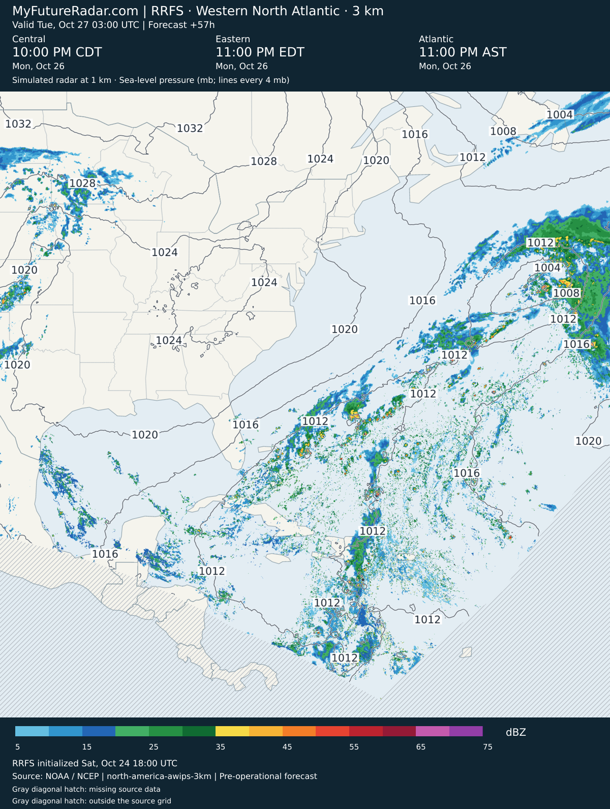
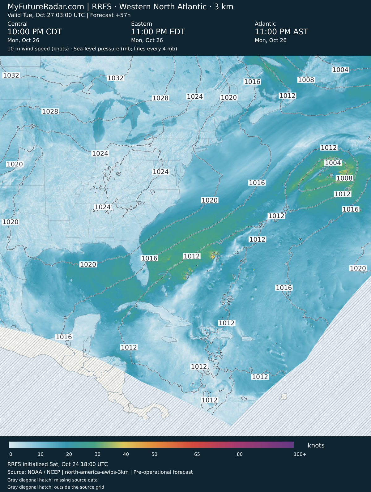
RRFS — Western North Atlantic hurricane view (3 km; every 3–6 hours) — (+57 hours)
Jump back to animated forecast
Simulated radar + sea-level pressure
10 m wind speed + sea-level pressure
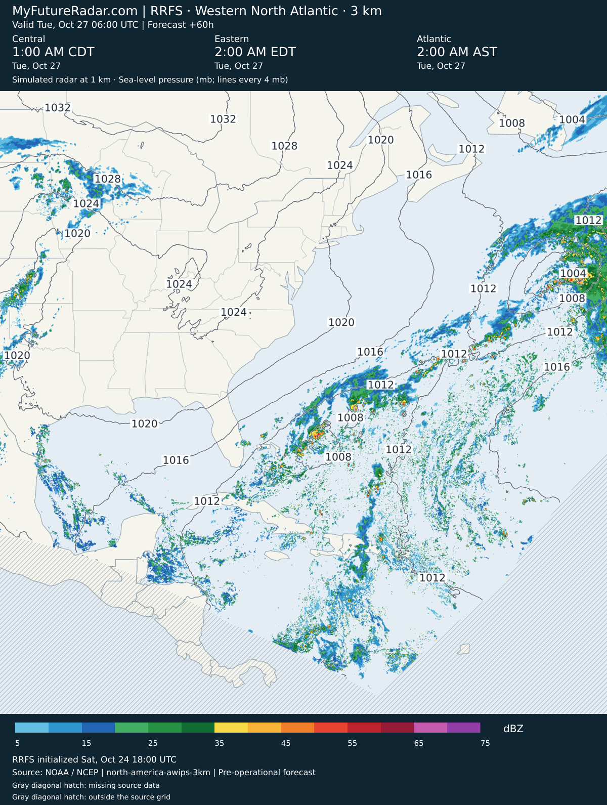
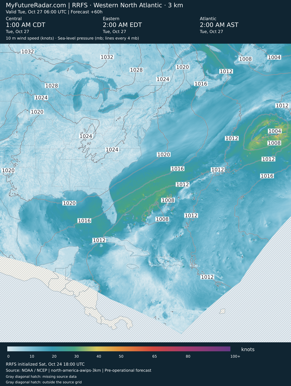
RRFS — Western North Atlantic hurricane view (3 km; every 3–6 hours) — (+60 hours)
Jump back to animated forecast
Simulated radar + sea-level pressure
10 m wind speed + sea-level pressure
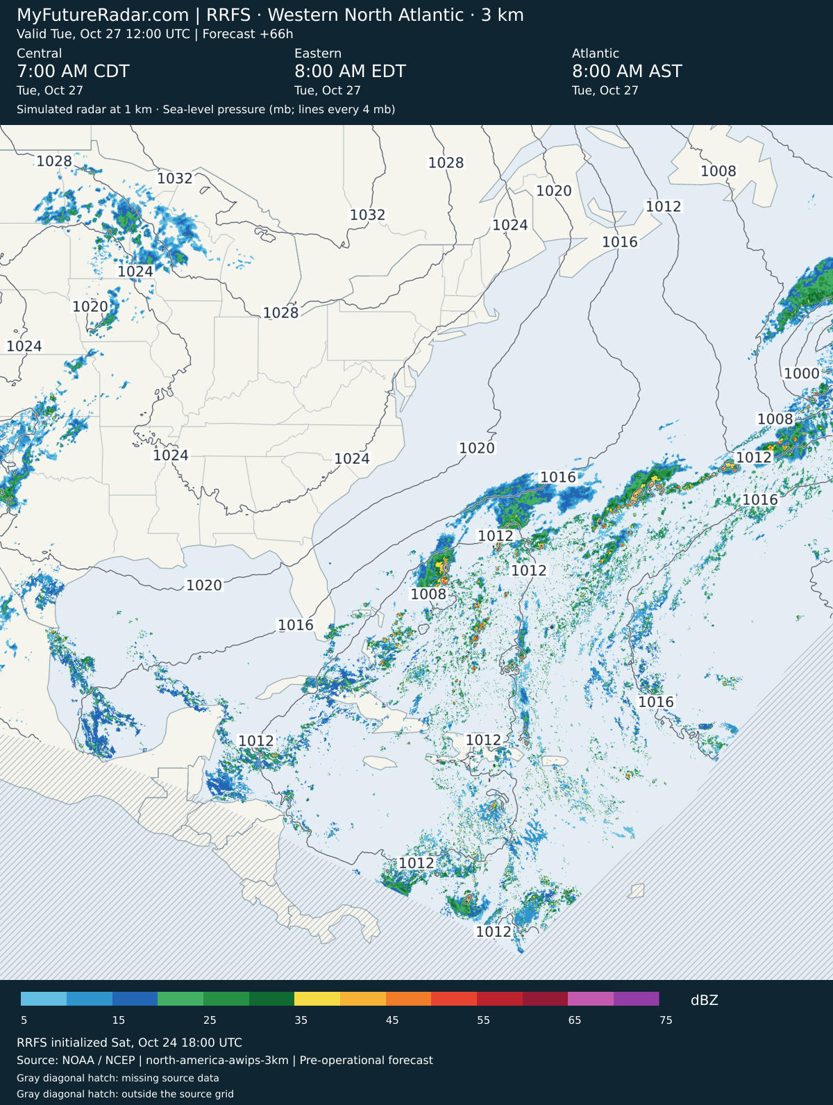
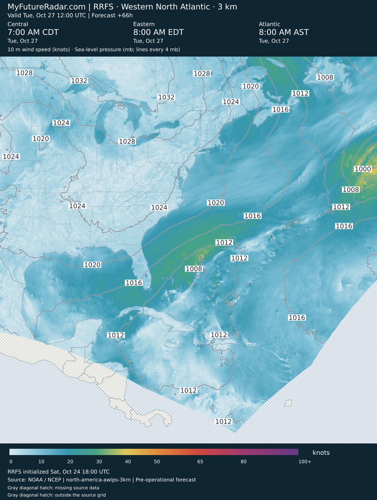
RRFS — Western North Atlantic hurricane view (3 km; every 3–6 hours) — (+66 hours)
Jump back to animated forecast
Simulated radar + sea-level pressure
10 m wind speed + sea-level pressure
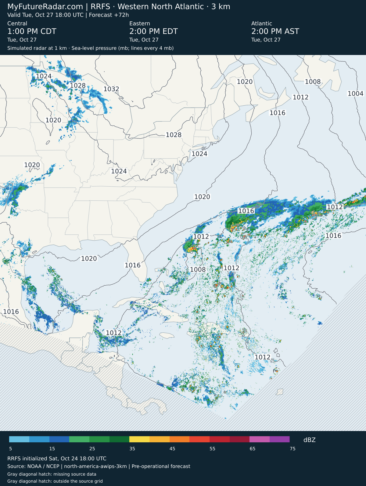
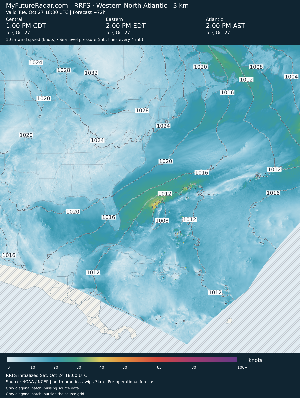
RRFS — Western North Atlantic hurricane view (3 km; every 3–6 hours) — (+72 hours)
Jump back to animated forecast
Simulated radar + sea-level pressure
10 m wind speed + sea-level pressure
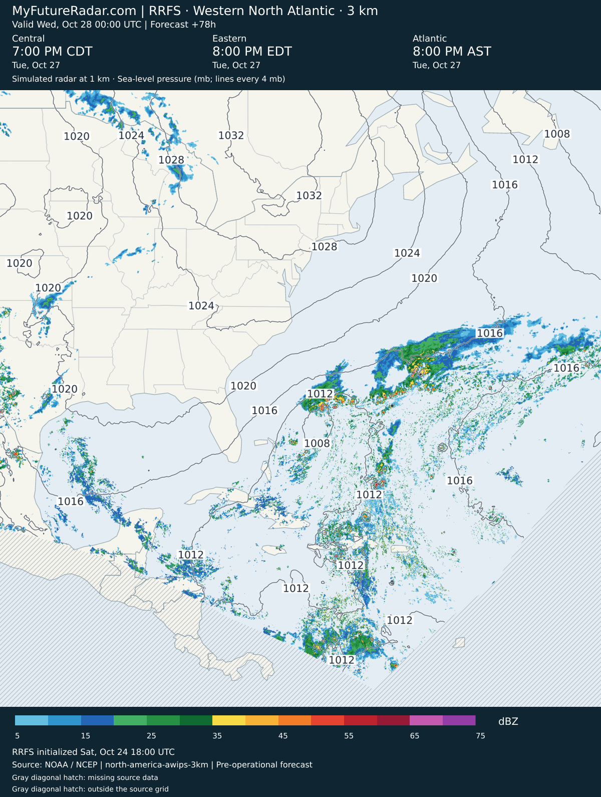
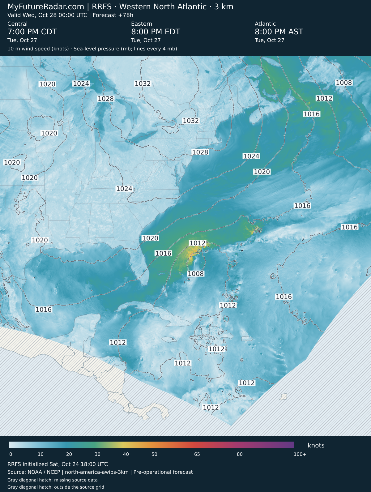
RRFS — Western North Atlantic hurricane view (3 km; every 3–6 hours) — (+78 hours)
Jump back to animated forecast
Simulated radar + sea-level pressure
10 m wind speed + sea-level pressure
RRFS — Western North Atlantic hurricane view (3 km; every 3–6 hours) — (+84 hours)
Jump back to animated forecast
Simulated radar + sea-level pressure
10 m wind speed + sea-level pressure
About My Future Radar
These are weather-model forecasts, not observations. HRRR provides an hourly short-range forecast; RRFS provides the extended forecast. The initialization and valid time identify the forecast shown. The loop shows Central, Eastern, Atlantic time, including the date and any daylight saving changes. Other page times use your device’s timezone.
You might also be interested in hurricane, typhoon and cyclone tracking on Cyclocane.